GPS Tunnel in the Sky

Note: The description below was excerpted from the paper: Tunnel-in-the-Sky Cockpit Display for Complex Remote Sensing Flight Trajectories by Andrew K. Barrows and J. David Powell, Stanford University. Presented at the Fourth International Airborne Remote Sensing Conference and Exhibition / 21st Canadian Symposium on Remote Sensing, Ottawa, Ontario, Canada, 21-24 June 1999.
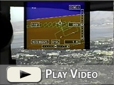
Three-dimensional flight displays can increase the efficiency of remote sensing flight operations by providing enhanced guidance and situational awareness on straight and curved flight paths. Such a display depicts an “out-the-window” perspective view of the world along with a tunnel through which the pilot flies the aircraft. Using differential GPS, inexpensive graphics hardware, and a flat-panel display, a prototype system was built and flight tested to demonstrate significant advantages over conventional instruments.
Flight testing on a Beechcraft Queen Air demonstrated the ability to guide the pilot on complex paths, while testing onboard a Beechcraft King Air confirmed accurate positioning of a hyperspectral imager over ground targets. With minimal training time, pilots were able to maintain good accuracy and navigational situational awareness using the display. These benefits could translate to savings in flight time and flightline overlap.
Aircraft operating cost is a significant factor for remote sensing missions. Platforms employed are typically multi-engine aircraft often equipped with expensive turbine powerplants. Costs of flight crew, sensor equipment and skilled operators are equally important. Effective use of these resources is therefore critically important. Efficiency can be enhanced by minimizing row overlap and maximizing time spent recording data. This in turn requires accurate positioning and guidance as well as good spatial awareness for the pilot. After flying over a ground point or flightline, a minimum of maneuvering should be required to line up for the next data run.

Systems have been developed to aid the pilot in these tasks. Such systems are based on position deviation needles, lightbars, moving maps, and even raw numerical information. All of these systems require expensive pilot training in realtime interpretation of the displays. Since none of these display types present an immersive depiction of the world, it is easy to lose positional awareness, especially when maneuvering from one target or flightline to the next. Often the pilot makes a 180-deg turn and must correct for gross errors until standard needle or lightbar guidance becomes available.
A prototype display has been developed at Stanford University that can address the unique needs of the remote sensing flight crew. The system uses the concept of a “tunnel in the sky” to present a three- dimensional view of the world and the desired flight path. Although the system was originally designed for general aviation instrument flying, developmental results suggest that it enables the precise path following and situational awareness demanded by remote sensing.

Flight testing demonstrated accuracy and situational awareness benefits of tunnel-in-the-sky displays for airborne remote sensing. The achieved accuracy indicated the potential to reduce overlap, missed spots, and time not spent taking data. The pilot was also able to maintain good position situational awareness relative to flightlines and targets, even in maneuvering flight. Because of the Tunnel Display’s intuitive presentation, these benefits can be had with less expensive training than typical systems. Additionally, the ability to fly arbitrarily complex patterns suggests potential applications in search and rescue, forest fire fighting, aerial application, and flight inspection.

Selected Papers (PDF) on the Tunnel in the Sky
Operational Experience with and Improvements to a Tunnel-in-the-Sky Display for Light Aircraft by Andrew K. Barrows, Keith W. Alter, Per Enge, Bradford W. Parkinson, and J. David Powell, Department of Aeronautics and Astronautics, Stanford University, 1997.
Alaskan Flight Trials of a Synthetic Vision System for Instrument Landings of a Piston Twin Aircraft by Andrew K. Barrows, Keith W. Alter, Chad W. Jennings, and J. David Powell, Department of Aeronautics and Astronautics, Stanford University, Stanford, CA, 1999.
Flying a Tunnel-in-the-Sky Display Within the Current Airspace System by Andrew K. Barrows* and J. David Powell, Department of Aeronautics and Astronautics, Stanford University, American Institute of Aeronautics and Astronautics Journal, 2000.
